The Expanded Freshwater and Terrestrial Environmental Observation Network
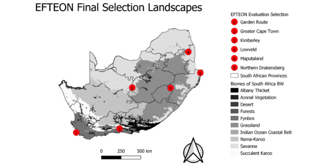
IMAGE: The National Research Foundation designates the long-term landscape-scale research sites of the Expanded Freshwater and Terrestrial Environmental Observation Network (EFTEON) Research Infrastructure.
Each EFTEON landscape was selected based on proposals, each written by a consortium of stakeholders. The landscapes are briefly described below, and the detailed proposals are available. Each landscape selected for development will have a dedicated team comprised of one scientist and three technicians. Our team is growing rapidly and are based in towns close to the monitoring sites.